A lot of Philadelphia sits on old fill, and anyone who has dug a basement in Society Hill or near the Delaware waterfront knows that what is on the map is not always what comes out of the hole. Geotechnical excavation monitoring here is less about textbook scenarios and more about reading the ground in real time. You have layers of Wissahickon schist that weather into micaceous silt, pockets of buried organic material from historic streams, and groundwater that rises fast after a nor'easter. We link the monitoring plan to the construction sequence, so that data from inclinometers and settlement points feeds back into the shoring design before a small movement turns into a claim. For deeper cuts in dense neighborhoods, we often combine continuous CPT soundings with the instrumentation layout to confirm the soil profile between boreholes and set realistic trigger levels for lateral movement. Our approach is driven by the practical reality of Philadelphia's geology: highly variable rockhead, compressible alluvium near the Schuylkill, and a water table that does not follow a simple gradient. We track what matters and ignore noise that does not add value to the excavation safety assessment.
In Philadelphia's urban fill, a well-instrumented excavation buys you time—the data tells you when to pause and when to push forward.
Scope of work in Philadelphia
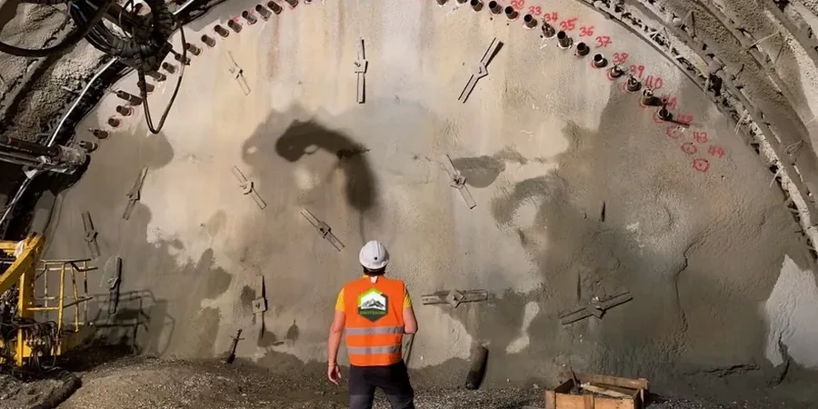
Local geotechnical conditions in Philadelphia
Southeastern Pennsylvania weather does not cooperate with excavation schedules. A sudden summer thunderstorm can dump 2 inches of rain in an hour, saturating the fill behind a soldier pile wall and doubling the lateral pressure before the piezometer alarm even triggers. Winter brings freeze-thaw cycles that open cracks in the ground, letting water infiltrate behind the lagging and soften the bearing stratum at the toe. We have learned to set two sets of trigger levels—one for dry conditions and one for storm events—because applying the same numbers year-round in Philadelphia is a mistake. The biggest risk we see is not instrument failure but interpretation lag: a crew collects data but nobody plots it against the groundwater hydrograph or the construction activity log for three days. By then, a trend that could have been caught early becomes an emergency. Our reporting cycle ties every reading to the excavation stage and weather record, so the project team sees correlations, not just raw numbers.
Our services
We tailor the instrumentation plan to the excavation support system and the sensitivity of adjacent structures. Every project starts with a baseline survey and a clear definition of what constitutes an actionable movement threshold.
Deep Excavation Instrumentation
Installation of inclinometers, extensometers, and load cells on tiebacks and struts for cuts deeper than 15 feet. We correlate deflection data with the construction sequence and provide daily interpretation reports.
Adjacent Building Monitoring
Pre-construction condition surveys, vibration monitoring, crack gauges, and optical survey points on structures within the zone of influence. Trigger levels are set per Philadelphia L&I requirements.
Automated Groundwater Monitoring
Vibrating wire piezometer networks with real-time telemetry. We track dewatering system performance and pore pressure response to precipitation, especially critical near the Schuylkill and Delaware floodplains.
Q&A
What does Philadelphia L&I typically require for excavation monitoring?
Philadelphia's Department of Licenses and Inspections reviews excavation plans under the IBC Chapter 33 framework. For deep excavations adjacent to occupied buildings, L&I usually wants a monitoring plan signed by a registered engineer that specifies instrument types, locations, reading frequencies, and clear trigger levels tied to specific response actions. The focus is on protecting the public right-of-way and preventing damage to adjacent foundations, especially in neighborhoods with unreinforced masonry row homes.
How much does geotechnical excavation monitoring cost in Philadelphia?
The cost depends on the number of instruments, depth of the cut, and duration of the project. For a typical urban excavation with a few inclinometers, settlement points, and piezometers over a 3- to 4-month period, monitoring programs in the Philadelphia area range from about US$710 to US$2.400. A more complex job with automated total stations and web-based data access will be at the higher end.
At what depth does Philadelphia trigger mandatory excavation monitoring?
There is no single depth that triggers monitoring automatically. The decision is risk-based. If you are excavating more than 10 to 12 feet near a party wall or within the influence zone of an existing foundation, monitoring is prudent. The geotechnical engineer evaluates the support system, soil profile, and building condition to define the instrumentation scope—depth is just one factor.
How do you handle monitoring when you encounter unexpected fill or buried structures?
Philadelphia is full of surprises underground—old foundations, buried piers, and heterogeneous fill. When the excavation exposes conditions that differ from the baseline geotechnical report, we increase the monitoring frequency immediately and add targeted instruments if needed. The data helps the design team decide whether the shoring needs to be stiffened or the excavation sequence modified without stopping work unnecessarily.
How fast do we get the monitoring data during active excavation?
For automated instruments like in-place inclinometers and piezometers, data is pushed to a cloud dashboard in near real time—typically every 15 to 30 minutes during critical stages. Manual survey readings are processed and delivered as a PDF report within 24 hours. If any reading exceeds the agreed trigger level, the project team receives an immediate alert by text and email so that decisions can be made the same day.